We summited Killington Peak, our 5th and final VT 4,000 footer on this NOBO Long Trail section from Mad Tom Notch to Inn at Long Trail.
Map
Note: This map is intended only to show the route. Mileage stats in section below were calculated using the End to Ender’s Guide from GMC.
Day 1: Mad Tom Notch to Griffith Lake
5.1 miles, 1,350ft of elevation gain
Hike Date: June 2021
Last summer, we hiked about 170 miles of the Long Trail and loved it. We were so excited to get back to the trail and backpack 50 miles from Mad Tom Notch to the Inn at Long Trail this summer. It takes more energy and time than you might think to drive up and get a shuttle to the trailhead, so we intentionally arrived in the late afternoon and hiked only 5.1 miles to camp. The weather was absolutely perfect with clear skies and cool summer temps. We truly couldn’t ask for better backpacking conditions.
When we hopped on trail, we were immediately reminded of how nice southern Vermont trails are. Sure, there’s some mud and roots, but nothing like the challenging terrain further north or in the White Mountains of New Hampshire. We trekked along the bog bridges in the afternoon sun, passed Peru Peak Shelter (where we filled up on water for the night), then some beaver ponds, and arrived at Griffith Lake Tenting Area before we knew it.
Starting at Mad Tom Notch
Mild trail to start
Bog bridge
Peru Peak Shelter
Bridge over water source
Beaver pond
At Griffith Lake, there’s a caretaker platform on the lake side of the trail and a small loop with tent platforms away from the lake. We stayed at site #4 which was just fine. Site #5 looks like the best though, if you have the option. While the tent sites are not along the water, there is a tiny side trail that leads to water access with a large sitting area and fire pit. It’s a great waterfront spot to hang out if you choose to camp or take a rest there.
Griffith Lake
Waterfront fire pit
Tent platform
Day 2: Griffith Lake to Minerva Hinchey Shelter
19.1 miles, 3,400ft of elevation gain
The next morning, we got on trail around 6am with cold breakfast and no coffee or tea. With so many miles planned for the day, we wanted to try getting the quickest of starts out of camp. We continued along the bog bridges to the end of Griffith Lake and its perfectly still early morning waters.
Bog bridges along Griffith Lake
Still waters in the early morning
From there, we headed into Big Branch Wilderness and began climbing Baker Peak. The climb was not too difficult and we went over some really cool rock formations through tiny stunted trees on the way to the top. At the summit, we got some brief views of the area and kept moving in our attempts to put in big miles early in the day.
Entering Big Branch Wilderness
Cool rocky ascent
Some views at the summit
After descending, we were greeted with thick mud and lush greenery, two things hiking in Vermont is known for. We passed by Lost Pond Shelter and saw some other hikers waking and getting ready to hit the trail. Then we crossed a bridge over Big Branch and took a quick rest to refill water and refuel with snacks on the banks a little before Big Branch Shelter.
Lots of mud in Vermont
Lush greenery on the Long Trail
Bridge over Big Branch
Shortly after Big Branch Shelter, there is a very brief road walk to connect with a Forest Service trailhead and parking lot with an outhouse available for use. We breezed right by and continued up the wide easy trail. The trail here stays pretty flat along a tiny stream before a somewhat rocky climb to Little Rock Pond. This was a perfect spot for us to take another rest and eat first lunch – yes, we needed two lunches on such a high mileage day! If the distances had worked out, this would be a great place to camp for the night and it offers some good looking spots to swim or lounge by the water.
Wide easy trail
Rocky climb
Arriving at Little Rock Pond
Little Rock Pond
Going north from Little Rock Pond Shelter, the trail was absolutely beautiful shining in the sun along the waterfront. We took in another good view of the pond from the north end before heading into the deep woods once again. The trail ascended gradually until we reached the Rock Garden, a slightly underwhelming rock jumble where hikers have arranged some stones into designs. Nevertheless, this was a perfect place to stop for a second lunch.
Waterfront trail
At the north end of Little Rock Pond
The "Rock Garden"
The best part of this area were the evergreens all around. Some tall and towering along with an endless expanse of little saplings blanketing the forest floor. It was simply a joy to hike through this section. Now into the afternoon hours, we came to White Rocks Junction with countless cairns arranged out of the namesake white rocks found there. This is what I was expecting the Rock Garden to be because I had mistakenly merged them into the same place in my mind.
Evergreens all around
White Rocks
Beyond White Rocks, we passed the side trail to Greenwall Shelter, crossed Bully Brook and VT Rt. 140, and pushed ourselves onward to Minerva Hinchey Shelter – our destination for the night. Along the way, we traversed yet another stunning fern forest and powered our way down the final stretch of trail feeling so ready for a long rest.
Crossing Rt. 140
Hiking through a fern section
Final stretch to the shelter
Beautiful fern forest
AT/LT sign
We arrived at Minerva Hinchey Shelter a little after 3pm having completed over 19 miles and feeling fatigued yet still strong – a great combo after our longest mileage day backpacking yet. After chatting with some hikers who were already there, we pitched our tent and sat to relax for the afternoon. We were exhausted in the best of ways and eager for more to come.
Minerva Hinchey Shelter
Our tent site near the shelter
Day 3: Minerva Hinchey Shelter to Cooper Lodge
14.1 miles, 4,500ft of elevation gain
We started the morning with another beautiful woods walk on relatively gentle terrain. The trail quickly took us to Airport Lookout and a decent view across the valley with, of course, a small airport.
Morning woods
Green forest on the Long Trail
Airport Lookout
Next, we crossed a bridge over Clarendon Gorge. It swayed and bounced with each step, but felt very sturdy otherwise. Just north of the gorge, we passed through some fields and trail sections with beautiful wildflowers still sparkling with morning dew. Sometimes it’s those little things along the trail that make for the best experience.
Bridge over Clarendon Gorge
Clarendon Gorge
Wildflower sparkling with dew
Overjoyed with the beauty of the flowers
After that, we made a short yet incredibly rocky climb up to Clarendon Shelter. While hiking this section in June 2021, Clarendon Shelter was under an advisory for bear activity. The Green Mountain Club, which manages the trail, had posted signs for all to know that a bear was frequenting the area and getting to hikers’ food bags. We heard from people on the trail that a bear had taken bags multiple nights in a row – an Ursak one night (which we highly recommend and carry ourselves) and a bear hang another night. From chatting with others, it seemed like no one was planning on staying there during this time. Hopefully, the situation improves for future seasons.
Past Clarendon Shelter, we kept climbing and then crossed a couple roads and stopped for early lunch by Gould Brook. It was only 11am, but starting the hiking day before 7am will always accelerate lunch time.
Rocky climb
Following the blazes across the road
Gould Brook
Beyond Gould Brook, we traversed a beautiful section of conifers and moss with soft spongy earth beneath our feet. It was truly a joy to walk through. This area also included some reminders that we were also on the Appalachian Trail. We passed a 500 miles from Katahdin sign as well as an AT survey marker. The AT splits off from the Long Trail after the Inn at Long Trail and heads east to New Hampshire while the LT continues north to Canada.
Trail through conifers
500 miles to Katahdin
Appalachian Trail survey marker
When we reached the last road crossing of the day, we took a bridge over Sargent Brook and walked a thankfully very short road section before heading back into the woods. Shortly after that, we came to Governor Clement Shelter, which sits just before the real climb up Killington, the 4,000 foot peak on this section. The trail from the shelter starts off as a wide hiking highway, turns upslope with a relatively gentle grade, and then becomes the expected rocky and rooty steep challenge that 4,000 footers require. And it was certainly a challenge for us at the end of a full hiking day on top of the fatigue from the previous day’s big miles.
Bridge over Sargent Brook
Wide trail hiking highway
Gentle grade to start up Killington
Steep, rocky, and rooty trail
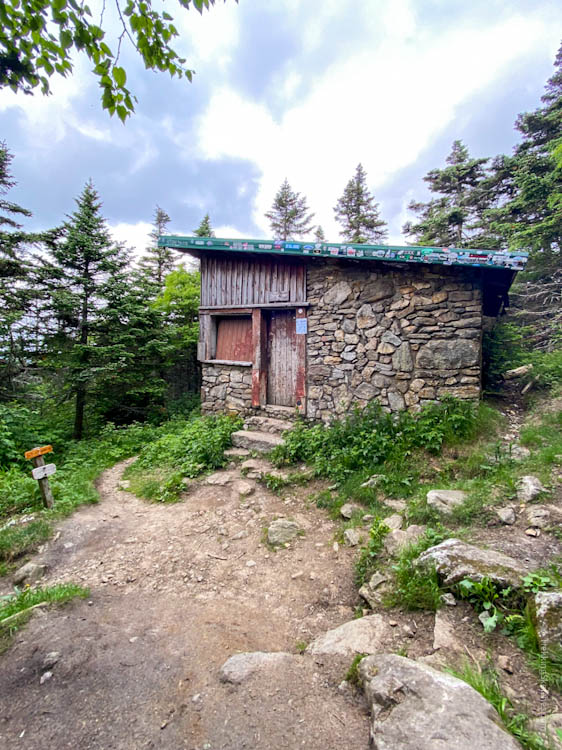
Once we had gained most of the elevation, the trail mellowed out and passed through some beautiful sections of greenery flecked with patches of bright sun. It was a great welcome to the mountain for us. When we finally reached Cooper Lodge, we sat with other hikers on the tent platforms while people shared their experiences and their plans. Situated about 0.2 miles below Killington Peak, Cooper Lodge is a beat up 4-sided shelter that is not inviting at all. There are, however, 3 tent platforms upslope and some tenting space available downslope as well as a nice spring for water. We set up on a tent platform while other hikers either dropped their packs and headed for the summit or deemed it not worth the extra effort on their thru or section hike. Since we were spending the night, we decided to wait for sunset for our summit time.
Tent platforms at Cooper Lodge
Sign for the trail to Killington Peak
Cooper Lodge
Spring at Cooper Lodge
We waited out the afternoon and the swarming black flies, which we heard were worse at the summit, by reading and napping in the tent. After dinner, we headed up the incredibly steep 0.2 miles to the summit of Killington Peak. It is seriously steep! Totally worth it for us working on our NE67 list, but I understood why some AT thru-hikers would skip it. Killington made for our 5th of 5 VT 4,000 footers. We had been there before, but only by hiking the short bit up from the top of the ski lift in the winter. That certainly doesn’t count for a hiking list. We kept going past the summit to check out the double black diamond chute run that we skied in the winter, Catwalk. It looked a lot less formidable without all the ice and snow!
Steep trail to Killington Peak
Almost to the summit
Catwalk ski run
When we first hit the summit, the clouds were just starting to roll over the mountain and engulf the peak. As sunset approached, those clouds swarmed and completely obscured any thought of a view. But then, for brief intervals of only seconds at a time, a tiny clearing would reveal a bit of beauty from the mountaintop. Along with an AT thru-hiker, we reveled in those seconds and felt gratitude for the opportunity and the experience. Not exactly what we envisioned, but exactly as it should have turned out.
This peak held extra meaning for us because we hiked it in participation of Summits in Solidarity, which is a hiking initiative for racial justice. Started in 2020, this was our second year of participation and we are excited to see the initiative grow.
Sunset from Killington Peak
Killington Peak summit area
Day 4: Cooper Lodge to Inn at Long Trail
5.6 miles, 400ft of elevation gain
We got another early start on trail and headed over toward Pico Peak. At the trail junction, we headed right, onto Shelburne Pass Trail. This trail used to be the Long Trail and Appalachian Trail, but those have been rerouted to the left of the ski area. Both trails are maintained and meet up on the other side of Rt. 4, but we chose to descend Shelburne Pass Trail because it brought us directly to the Inn at Long Trail where we left our car. The inn is also a great option for thru-hikers to get some food, spend a night, and resupply. They accept mail drops for hikers and there is a bus route into Rutland that stops at the inn.
Trail toward Pico Peak
Trail junction with Shelburne Pass Trail
Shelburne Pass Trail quickly passes Pico Camp and we chatted with a few hikers who were getting ready after spending the night there. Further down, the trail meanders onto and off of the ski slopes a couple times before veering into the forest for good. The last mile can sometimes seem the longest and that was certainly true for us heading out on this last day of the section. We felt great emerging at the hiker parking lot across the street from Inn at Long Trail. We finished our final VT 4,000 footer and only had about 50 miles of the Long Trail left!


Be First to Comment