Section-hiked the first 70 miles of the Long Trail in Vermont from the Southern Terminus to Mad Tom Notch and can’t wait to complete the rest. The Long Trail spans the entire state, running 272 miles from Massachusetts to Canada. The Appalachian Trail coincides with the first 105 miles of the Long Trail before splitting off and heading east toward New Hampshire.
Map
Note: This map is intended only to show the route. Mileage stats in section below were calculated using the End to Ender’s Guide from GMC.
Why the Long Trail?
Since the start of the COVID-19 pandemic, we’ve had to cancel and change a lot of plans, including a trip to hike the Tour du Mont Blanc in August. Since we were unable to do that, we wanted to tackle some kind of hiking goal while staying responsible. Kevin has wanted to thru-hike the Long Trail for years, but between COVID, finding shuttles, and managing work schedules, taking off 3 weeks to do that seemed too complicated. Instead, we compromised and decided to section-hike it. We started hiking Northbound (NOBO) from the southern terminus because this section is easier than other parts, runs closer to towns for potential bail out options, and coincides with the Appalachian Trail, which absolutely added to its appeal.
We were quite conservative with our mileage each day in order to prioritize relaxing and enjoying the outdoor experience. Since this was our first multi-day backpacking trip together, it really became more of a “shakedown” of our gear and a test of whether or not Kathy liked backpacking or not. Luckily, she loved it, so more backpacking will be in store for the future! Preparing for section-hiking the Long Trail included a lot of food preparation, careful packing, and poring over maps. Often, half of our fun comes in the planning and anticipation of a trip!
Studying the mileage, elevation gain, and planning our camping spots
Food prep (note: we opted for bear canisters, but plan on using an Ursak to save weight next time)
Gear prepped and ready
Day 1: North Adams (Southern Terminus) to Seth Warner Shelter
6.6 miles, 2,300ft of elevation gain
Hike Date: July 2020
To start our NOBO Long Trail journey, we parked at the hiker parking lot across the street from Greylock Community Club in North Adams, Ma. They monitor the parking lot and it’s along a well-lit main street, so it’s safer than others. Greylock Community Club accepts donations in appreciation, just leave a note with hiker info and planned dates in their mailbox.
We began hiking by 12:30pm, joining the Appalachian Trail in town. It crossed a bridge over the Hoosic River, turned right along a road, and then left between some houses to head north into the woods. One of those homes had a lovely garden with a hose installed along the trail with a sign encouraging hikers to use it. We ran into the homeowner as he was hiking down the trail. He said thru-hikers should hose themselves off and fill their water bottles – so generous and thoughtful! It’s this type of spirit that has us pondering an AT thru-hike.
Greylock Community Club
AT sign in resident's garden
The trail climbed steadily, but it wasn’t too difficult. There was one brief section of rock jumble to contend with, but it was over before we knew it. 3 miles in, Kathy was stung in the ankle by something, maybe a ground hornet, so the first aid kit came in handy right away!
Appalachian Trail white blaze
Rocky jumble section
Fern forest
After the climb, the trail flattened out and passed through a giant fern forest. When we reached the VT border and the Long Trail sign, we took our first real break. We read the log book and signed it ourselves, marking the true beginning of our journey on the Long Trail. We marked this start with a picture at the sign and then followed the easy trail to Seth Warner Shelter, the first shelter along the Long Trail in VT.
The Long Trail Southern terminus sign
Seth Warner Shelter is a simple lean-to with plenty of tenting space around it, a bear box for food storage, and a stream nearby as a water source. It’s close to some ATV trails so we heard engine noise throughout the evening, but earplugs would definitely be advised for light sleepers spending a night here. The area clearly gets heavy usage based on the remnants of trash littered around the tent sites, which is unfortunate, but otherwise it was a fine place for our first night on the LT.
When we reached Seth Warner Shelter by 4:30pm, we were the only ones there. We set up our tent unsure what to expect in terms of crowds or not. Turns out only 2 other hikers joined us through the evening, 1 just started a NOBO thru-hike, the other on a SOBO overnight. It poured overnight, but we stayed dry.
Seth Warner Shelter
Seth Warner Shelter bear box
Day 2: Seth Warner Shelter to Melville Shelter
13.1 miles, 3,000ft of elevation gain
After hanging around camp for a leisurely breakfast, we started on trail by 8:30am. First, we hiked over some power line cuts in the damp morning mist and gusting winds. The trail then passed some beaver ponds with long sections of bog bridges. There were some clear campsites along the trail near and between the ponds for anyone looking to primitive camp instead of staying near shelters. The power line cuts and beaver ponds were some of the only times we emerged from the “green tunnel” of the Long Trail, so we would always take a moment to enjoy the bright sky overhead.
Misty morning trail
Power line section in the fog
Green tunnel
Beaver pond
We paused for a long lunch by a stream and did some foot care soaking them in the stream and bandaging our first hot spots and developing blisters. This long break had us feeling really rejuvenated. A good break halfway through the hiking day, can make you feel like you’re just getting started!
After lunch, we passed Congdon Shelter. It has a few bunks inside and plenty of space for tents around it. Then, the sun came out to light up a fern wonderland beyond the shelter. So much beautiful bright green carpeting the forest floor, it was a highlight of the day! We enjoyed another break and some snacks on Harmon Hill overlooking Bennington. With the sun high in the sky, we took the opportunity to lay out some gear to dry.
Congdon Shelter
White blaze in ferns
View of Bennington from Harmon Hill
Fern wonderland
The next section involved the toughest terrain yet on the Long Trail. The descent to Rt. 9 was super steep with rock steps and boulders for footing. We took a break to refuel by the road and then crossed the bridge to begin the ascent on the other side. The climb up through Split Rock to Melville Shelter was steep, but not as rocky and aided by more switchbacks. It still made for a pretty tough end to the day, though.
Descending rock steps
Trail up to Split Rock
Split Rock
Melville Shelter has a small stream running over the trail, but it was incredibly low when we were there following dry weather. We were able to get water, but it required scooping and was pretty yellow. For this trip, we opted to use our Sawyer Micro Squeeze with a SmartWater bottle for our water filter system. It worked like a charm. The Micro Squeeze’s flow rate is faster than the Sawyer Mini, but it is more compact than the regular Sawyer Squeeze. The SmartWater bottle is thicker than many other typical plastic bottles and can easily be placed under a small trickle of water and won’t collapse like the bags that come with Sawyer filters. The shelter had a few bunks in it, a picnic table out front, and a few spots for tents. The ground was pretty rooty and not totally flat, but we made it work. There was no bear box, so plan on hanging your food or packing a bear canister. We spent the night playing cards and chatting with a hiker who we met the day before at Seth Warner Shelter and was hiking the full Long Trail. It was really nice to chat with Trademark (his trail name) about hiking, traveling, and his experience thru-hiking the AT. We also realized that we had all lived in the same neighborhood in New York years before – what a small world!
Melville Shelter
Day 3: Melville Shelter to Kid Gore Shelter
12.6 miles, 2,800ft of elevation gain
We got an earlier start, starting on trail by 7am. The trail quickly passed over a power line cut, the only time you see the full sky. For most of the morning, we hiked through Glastenbury Wilderness, passing a couple overlooks with small tent spots nearby. We saw lots of bright orange newts on the trail, a recurring sight for us on the LT.
Power line cut clearing
Little Pond Lookout
One of many bright newts we saw along the trail
Campsite by Little Pond Lookout
The trail on the way up to and past Goddard Shelter was really pretty. The pleasant forest smells did a great job masking our growing hiker stench. It got a little bit steep heading up to the shelter, so we were thrilled when we got to a really nice spring that provided some of the best water we had on trail. We took a moment to relax there knowing that Goddard shelter was just up the way. Goddard Shelter is well-built and has a covered porch to hang out and stay sheltered from any bad weather. This was probably one of the nicest shelter setups we saw during our 5 days.
Trail to Goddard Shelter
Goddard Shelter
Spring at Goddard Shelter
After the shelter, we climbed the short but steep bit to the top of Glastenbury Mountain and passed some great places people have camped. There are no views unless you climb the rickety fire tower. Luckily, it was a beautiful day and we were willing to ignore any fear of heights to get our first views of the trip. After snapping some pictures and carefully descending the fire tower, we hung out on the summit, which is an incredibly open space with many places for people to camp. We rested, refueled, and even did some trail laundry of our now pretty stinky clothes. They didn’t have time to dry, but putting on a clean wet shirt is way better than a stinky sweaty wet one. We chatted with other hikers who joined us at the summit, feeling grateful for great company with clear weather and fluffy white clouds as we had expected rain every day.
Hiking up Glastenbury
Glastenbury Fire Tower
Campsite atop Glastenbury
On Glastenbury Fire Tower
View from Glastenbury Fire Tower
Knowing we only had a few miles of trail to get to where we were sleeping that night, we made quick work of the last few miles of trail through the sun-speckled forest. Kid Gore Shelter has a few bunks, a picnic table out front, decent spring water, bear boxes for food storage, and a great view to the East, so we were looking forward to sunrise. Turns out that sunset was pretty nice too as the clouds caught the last rays of the day and turned cotton candy pink. This was the first time we opted to actually sleep inside a shelter and it was a great place for it! Note: sleep with your feet towards the inside of the shelter and head towards the outside. Apparently, little critters like to run around the back! Also, if you are a light sleeper and there are other hikers around, it might not hurt to bring some earplugs. For those looking for tenting, there was 1 spot right by the shelter and then plenty of space just north along the trail, where there was also another spring for water.
Kid Gore Shelter
Sunset view from Kid Gore Shelter
Day 4: Kid Gore Shelter to Stratton Pond Shelter
15.3 miles, 3,100ft of elevation gain
We awoke in a cloud, so we didn’t expect much from the sunrise. After heating water for breakfast, though, the swirling mist started to dissipate and we got a few good views.
Cooking breakfast at Kid Gore Shelter
Sunrise from Kid Gore Shelter
We started on trail around 7am again as some sprinkling rain started spitting on us. We put our pack covers on right away and it promptly stopped. The morning mist continued to burn off as we walked past more beaver ponds and then up to Story Spring Shelter. There were no bunks at this shelter, but it had a big clearing out front, plenty of space for tents, and a good spring just past it for water.
Hiking in the morning rain
Beaver lodge
Story Spring Shelter
We came across the muddiest trail sections so far past Story Spring Shelter, showing us why some hikers call this state “Vermud.” Despite the squishy terrain, we cruised through this mostly flat section to take a break by Black Brook and the streamside campsite there. After that, we crossed over Kelley Stand Rd and headed up Stratton Mountain.
They call it "Vermud" for a reason
Campsite by Black Brook
Stratton Mountain sign
Hiking the trail up Stratton Mountain was a wonderful experience. We noticed more and more evergreens as we went further into the forest and gained more elevation, which reminded us of our experiences hiking the NH48 in the White Mountains. Practicing walking meditation, we kept a steady pace feeling strong on the hike to the summit. We only paused briefly to put our pack covers back on when it started raining again. Once it stopped, the sun came out and gloriously lit up the wet moss, ferns, and trees along the steep trail.
Hiking up Stratton Mountain
Trail up Stratton Mountain
Close to the top, we filled up our water bottles at a beautiful spring (it wasn’t marked on the Guthook App, so it might not always be running). After that, the ascent was a little deceptive. The trail flattened out and it felt like we were so close to the top, but it took longer than expected to reach it. On the summit, we climbed the fire tower and took in the views from the top that inspired the creation of the Appalachian Trail. They are pretty great, probably made even greater when juxtaposed with the green tunnel that is the Long Trail in southern VT. We truly enjoyed our time on Stratton and it made us realize how much we favor higher elevations over lowland forests.
Deceptive climb up Stratton Mountain
Spring on Stratton Mountain
Stratton Mountain Fire Tower
View from Stratton Fire Tower
Hearing some thunder in the distance, we quickly finished our lunch and dropped down the other side of the mountain as another spurt of rain came down. Past the spring on that side, the trail became a rocky stream, making footing difficult. But, luckily, the sun came back out, and its rays reflected off of the water droplets, making the green foliage even more vibrant than before.
Stream or trail?
Hiking down Stratton Mountain
When we descended back in the lower forest, a true storm rolled in and the thunder encouraged us to quicken our pace to reach Stratton Pond Shelter. Initially, we thought about camping at a tentsite on the other side of the pond, but knowing a storm was coming made us change our plans to stay at the shelter. This was by far the nicest shelter we saw on the Long Trail. It was huge, with nicer bunks that reminded us of albergues on the Camino de Santiago, a loft area for overflow sleeping space, a bear box for food storage, and a large covered porch with a picnic table.
Stratton Pond Shelter
Stratton Pond Shelter bunks
The storm passed and then we headed down to Stratton Pond, about ¼ mile down the trail. The view of the pond there is absolutely stunning — maybe one of the best views of our 4 days. We enjoyed swimming and basking in the sun through the afternoon.
Trail to Stratton Pond
Post-hike relaxing by the pond
We ate dinner at the shelter and then returned to the pond for sunset where we were treated to an enchanting show from the clouds and the fading light. The water turned still as glass and reflected the shoreline trees and the bruised sky beautifully. As the two AT section hikers from North Carolina who were sitting next to us said: it looked like a cotton candy sky. This was undoubtedly an absolute highlight of our trip!
First glimpses of the sunset over Stratton Pond
Sunset with a cotton candy sky
Day 5: Stratton Pond Shelter to Manchester Center
9.9 miles, 500ft of elevation gain
We had cold breakfast and got on trail a little before 7am, looking forward to getting into town for resupply and a shower. Trail life had been great, but a hot lunch and some real soap was in order.
We passed by Stratton Pond and the early morning mist was drifting beautifully and hauntingly over the perfectly still water. Less than a quarter mile into our hike, we just had to stop and admire the scene.
Stratton Pond in the morning mist
Stratton Pond island reflection
After that, the trail was pretty flat through Lye Brook Wilderness, though very muddy, and we made quick time to Prospect Rock. The view from there looks down into Manchester Center, our destination for the day.
Lye Brook Wilderness
Long Trail - that way!
At Prospect Rock, we got the card of a local shuttle driver from two other hikers – we would use that later. From this point, we got off the Long Trail and headed down Old Rootville Rd, a dirt and gravel road down to a small hiker parking area.
View from Prospect Rock
Hiking Old Rootville Road
Then, on the drivable portion of the road, we passed some cute homes to reach the outskirts of town and the Rest, a Modern Motel, our intended lodging for the night. They offer hikers a rate of $125 a night and we luckily got a room with a hot tub, perfect for relaxing our sore legs.
We were feeling really proud of our accomplishment and even more jazzed for a hot meal in town until Kathy discovered a pretty gnarly blood blister on her toe. Even though it didn’t hurt that badly, it looked pretty concerning. So, after showering, we headed into Manchester Center for a leisurely lunch and now, an urgent care visit. The road walk into town is kind of long, about 2 mi, along the shoulder of a busy road, but it was OK and we always had room to feel safe enough.
Will road walk for pizza!
Road walk to Manchester Center
After scarfing down some pizza and salad (yes, Kathy craves salad at all times) along side Shed beer (our favorite), we paid a quick visit to the urgent care facility in Manchester Center. The good news: blood blisters really aren’t a big deal and even one of this size should heal in a week or so. The bad news: they will only heal if you rest and stop hiking. If Kathy kept hiking, the potential concerns would be even longer healing time (meaning no hiking) and in the worst case, a skin graft. The doctor asked an important question: “do you have to finish hiking this section now?” The short answer was, no. Although we really wanted to hike 4 more days to Killington, we were section hiking and there really was no reason to risk anything or prolong a recovery time when being physically active is so important in our lives. Disappointed, we decided to take a few days break off trail to let Kathy’s toe heal. At least we stopped at a Dutton Farmstand to get some beer from The Alchemist and maple ice cream to make it better.
Shed Mountain Ale
Blood blister
Day 6: Mad Tom Notch to Bromley Mountain
2.5 miles, 900ft of elevation gain
We left Vermont to take a 3 day hiatus at a family member’s lake house. As soon as we saw Kathy’s toe start healing, we decided to get back on trail for just one more night to get some more miles in while we had vacation time. It was great to get back!
To save her toe, we opted to hike SOBO from Mad Tom Notch back to Manchester Center (where we left off), which has distinctly less elevation gain. Starting in the late afternoon, we made quick time of this nice section of trail climbing Bromley and set up camp in the clearing by the ski lifts. Even though there is a shelter not far, a few different hikers gave us the tip to camp on Bromley to get views in all directions and perhaps a beautiful sunset and sunrise. There is a privy up there and Bromley leaves their ski patrol building open for hikers to use in inclement weather or to safely store food for the night.
Trail up Bromley Mountain
Approaching Bromley Mountain summit
Bromley Mountain is a great place to spend the night and we would recommend it to AT and LT hikers. It seems like other hikers had this same idea as we were joined by three other groups before we settled in. It was here that we met a hiker named Breadcrumbs who gave Kathy the great tip to try wearing XOSKIN toe socks when hiking to prevent those pesky in-between-the-toe blisters that she is so prone to. Immediately, she ordered some and has loved them!
When we tried to prepare dinner, we realized that we had forgotten to pack our utensils! Whoops. Not the end of the world for an overnight, but we better not make that mistake for longer sections. Kevin got a little crafty and whittled some chopsticks for us. They worked out perfectly for our chicken and rice meal!
Using our brand new chopsticks for dinner on Bromley Mountain
Some clouds rolled in and we got a bit of a sunset view, gazing down a ski slope and out at the waves of mountains in the distance. Then the wind picked up and a strong squall dumped rain, sometimes sideways, as we fell asleep. It was a good test of our tent – now we know it can handle some strong winds and powerful gusts while keeping us dry in a downpour.
Sunset from Bromley Mountain
Tent city on Bromley Mountain
Day 7: Bromley Mountain to Manchester Center
10.1 miles, 1,200ft of elevation gain
The morning sunrise was also somewhat obscured by clouds, but wonderful nonetheless. We packed up camp and headed down the trail, actually the top of one of the slopes for the first quarter mile or so. Then, it headed into the woods and past Bromley Shelter, 1 mi below the summit. From there, we had a pleasant stroll through the woods, crossing over Route 11/30, and climbing a bit over Spruce Peak and past Spruce Peak Shelter. Once we made it back to Old Rootville Rd, we walked down the now familiar gravel path to the hiker parking where we left our car the day before.
Sunrise from Bromley Mountain
Hiking down Bromley ski slopes
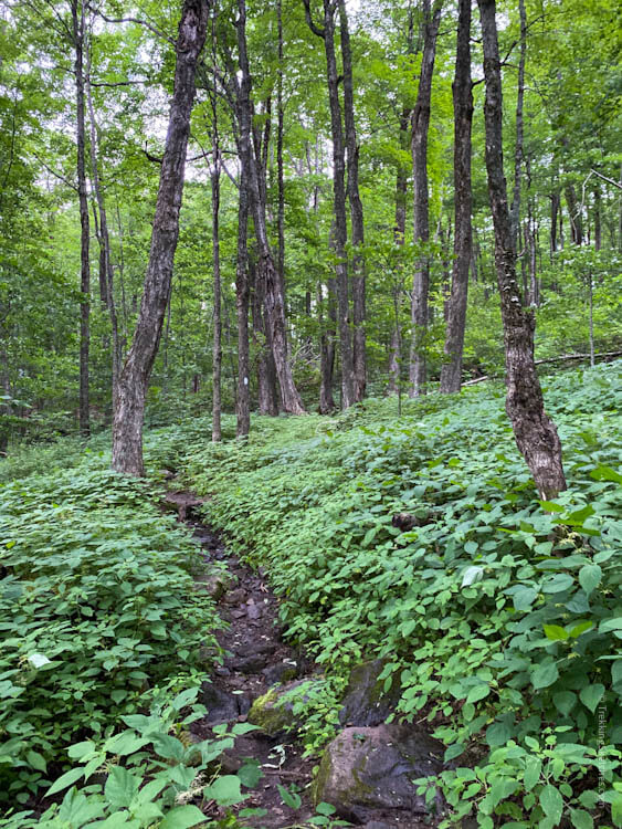
Trail section with nettles
This first Long Trail section really whetted our appetite to finish the entire thing and become “end-to-enders.” We are planning our next sections now and can’t wait to get back out there.


The leech! Really happy your toe felt better and I know you’ll accomplish the end-to-enders goal.