Days 7-13: Hiking the Appalachian Trail Through Massachusetts
It has been another week on the Appalachian Trail! These last days have flown by and we are truly loving trail life. We have officially hiked about 150 miles and are so proud of ourselves. This is the longest backpacking trip we’ve ever taken and it is still just the beginning! When we got into a CVS in Great Barrington, the clerk asked us, “where are you headed?” To which Kathy responded, “Do you mean in life?” Clearly, we have a lot of time to reflect when all we do is walk and think all day.
We are learning a ton about ourselves and backpacking together. Kathy’s calves, Achilles tendons, and ankles, as per usual, can get pretty sore and swollen. She’s wearing compression socks and stretching every day. Kevin’s left Achilles tendon and right IT band in the knee have been bothering him a bit, but we stopped at an outfitter and got him some Superfeet Green insoles that are helping a lot. We are both using lots of KT tape as well. These feel like expected pains from a lot of overuse and nothing to be too concerned over. Just things to manage and treat along the way.
Other than that, we are really learning how to slow down, be present, be more flexible, and set our ego and pride aside as we figure out how much to hike each day. We are so used to day hiking and doing tons of miles, but we are constantly reminding ourselves that this is a marathon, not a sprint. As such, we are trying to go slower than we sometimes want, at more like 13 miles per day on average for the first few weeks. We are constantly tempted to do more, but know that this isn’t about what we “can” do in the moment. Rather, it’s about what is best for our bodies and the long term goal of finishing the AT. This is a tough but important lesson to learn! Our longest mileage day was 16, but then we spent the next day taking it easy and doing about 10.
Another thing is that we are so accustomed to planning every detail to achieving goals we set out for ourselves. The reality is that on trail, there are things you can predict and prepare for, but you really have to remain flexible. Some days you plan to hike further, but what if you are tired? Or it’s pouring? Or what if you want to keep hiking but you have to resupply? How do you wrap your head around changes in plans? It’s really difficult, but having a plan and at the same time being open to changing the plan is essential out here. This is also probably a great lesson for life off the trail as well!
The last week has been so fulfilling. Hiking through Massachusetts felt so familiar. The terrain became more rocky and rooty and the climbs more challenging. Most importantly, getting to stay in the Berkshires at our friends’ parents’ house where we’ve stayed many times before for our first zero day was really comforting and exactly what we needed. Peter, Anna, Peggy, Ron, and Hank, thank you so much for always opening your home to us! We love you!
Now, bye Massachusetts (and all of your awful mosquitos) and hello Vermont!
Day 7, 6/24/22: Great Barrington to North Wilcox Shelter
13.6 mi, 3400 ft elevation gain
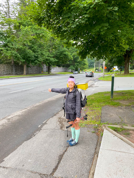
Woke up feeling pretty rejuvenated after a night in a bed! We took advantage of the included breakfast and revved ourselves up to hitchhike the 3 miles on Route 7 back to the trailhead. We held our thumbs out for about 5 minutes and heard a honk from a car behind us. Yay, it was Poppa Joe! A local known for giving hikers shuttle rides and in the front seat was Bucky, a hiker we met a few days prior. This felt like the definition of “the trail will provide.” He asked our trail names, what backpack we were using, where we were from, took our picture, accepted a small donation from us, and dropped us off.
This was our first pretty hot day of hiking. The sun was beating down on us. The first part was relatively flat meadow walking, then we did a couple of climbs, one that had a really nice view from a rock slab. Continuing on, we took a pause at Tom Leonard Shelter where we chatted with a Nobo thru hiker we’d been playing leapfrog with for the last week.
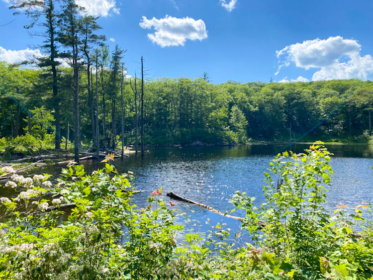
We pressed on in the heat, sweating way more than days prior. We didn’t get a ton of views today, so we were surprised by how much elevation gain we had in 13 miles. There wasn’t anything particularly memorable about this stretch. But, our friend, Anna, gave us intel that Benedict Pond would be a great place to stop for a break, and wow was she right. After a climb, we came to a beautiful body of water. We found a little area of rocks at the edge of the pond and dipped our feet into the water which cooled us down immediately and relaxed our overworked muscles. For lunch, we made salami and cheese sandwiches on fancy bread we bought in town the day before. This was a perfect respite on a hot day.
It was only a few more miles to the shelter. We passed a beaver pond and watched a beaver swim. At camp it was incredibly buggy, but we made the best of the situation, put on copious amounts of bug spray, played cards and enjoyed making dinner. Around 9:30pm, we heard an incredibly loud owl calling to another over our heads. What a great way to end the day.
Day 8, 6/25/22: North Wilcox Shelter to Goose Pond Road
11.5 mi, 2200 ft elevation gain
Can we just call Massachusetts Mosquitochusetts? So many bugs! We woke up relatively early to get a head start before it started getting hot. Coming out of North Wilcox shelter was decently mild. Then we dropped elevation down long and winding switchbacks between nettles, jewel weed, and ferns. We filled up water near Shaker Campsite and were grateful for any flowing water today (it has been very dry in MA), and started the climb up Tyringham Cobble. The AT trail up Tyringham Cobble coincides with another local trail and was marked by both a blue and white blaze. We emerged at the summit and saw an example of true nature: a snake had just caught a toad for its next meal.
At the summit, we enjoyed a break, not at the lovely placed bench in the blazing sun, but next to it on the rocks under the shade. It was in the high 80s and by far the hottest day for us so far.
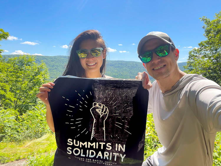
Today’s hike was also in honor of Summits in Solidarity, an initiative for racial justice and inclusion, particularly in outdoor spaces.
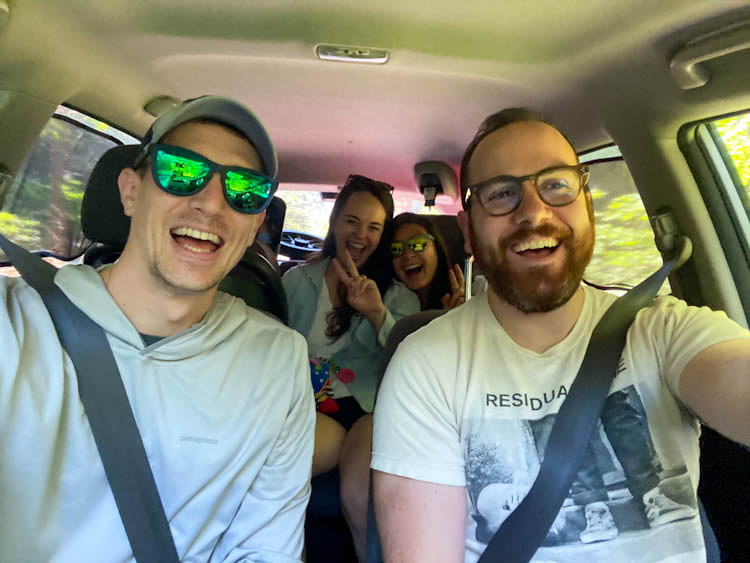
We headed down and then had only one more big climb before the end of the day. Knowing that our friends were meeting us at Goose Pond Road to get us off trail for the night, we moved as fast as we could.
Day 9, 6/26/22: Zero Day in Otis, Massachusetts
We’ve quickly learned how hard it is to rest. However, having great friends and family who are there for us on days we need it and encourage us to take care of ourselves has been so important. We ended up taking an unplanned zero to nourish our bodies and spirits. We played games, made delicious food, drank beer, and spent quality time with people we love. This is exactly what we needed!
Day 10, 6/27/22: Goose Pond Road to October Mountain Shelter
11.8 mi, 2100 ft elevation gain
Well, hello rain and bugs! We waited out the downpours of the morning and got on trail around noon. It was still coming down, but much lighter and ended up stopping after about an hour. It is actually good that it rained because water sources in Massachusetts have been pretty dry.
The terrain today was very pleasant. We didn’t gain too much elevation and the climb to Beckett Mountain was rocky, but not terrible. We paused to rest at the summit and relished the one place that didn’t have mosquitos everywhere!
The rest of the day was uneventful in the best way possible. We got into a nice flow and got to camp by 5pm for dinner. The big thing we realized is that we have officially hiked over 100 miles!
Day 11, 6/28/22: October Mountain Shelter to Crystal Mountain Campsite
15.5 mi, 2,200 ft elevation gain
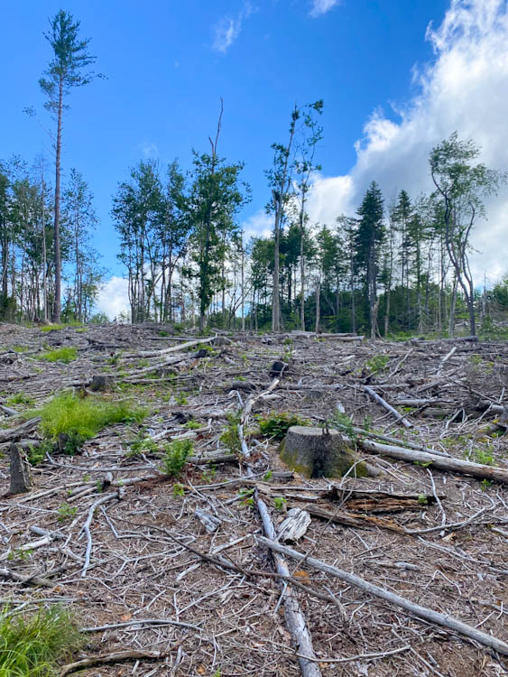
Goodbye rain! Unfortunately the bugs remained. We were the last out of the campsite this morning. Right away, we crossed an area where an old stand of non-native Norway Spruce planted on abandoned farmland had been cleared by the state to open the land for native trees. Just a few miles further, we came upon a road crossing and a sign for the Cookie Lady. Initially we weren’t sure if we should take the time to stop, but we decided to walk the hundred feet or so over to her and wow are we glad we did! Don’t be fooled by the “closed” sign on the blueberry shack. We walked down the driveway and saw a house with a picnic table, a box of cookies, bandanas for sale, and a sign-in book. The daughter-in-law of the cookie lady greeted us with her adorable puppies and mason jars of the most refreshing hibiscus lemonade. We used some of their charging stations, dropped some cash in the donation box, took a cookie for the road, and continued onwards.
The rest of the morning’s walk was lovely and mild. It was a pretty forest walk with a little undulation for most of the day. We paused for lunch at Warner Hill with a beautiful view of Mt. Greylock and chatted with a hiker from Hiawassee, GA. There were huge blueberry bushes and blackberries up there too, but they weren’t ripe yet.
Got a Fanta from a trail magic cooler at the next road crossing. So much trail magic in MA! We dropped down a bit into Dalton, where the AT goes almost directly through the town. We stopped at Angelina’s to grab a massive chicken and bacon sub to split. There, we met a father and daughter hiking the trail together with mother and son (ahead on the trail). The father is carrying a computer on trail and working along the way. So many ways to hike the trail!
Kevin’s right knee was still hurting and it became clear that it was having IT band issues. Used some KT tape for it which should really help it out. Kathy swears by it and thought it would be right for the job. He also solicited some advice from our sister and personal quasi PT, Claire, who knows a ton about endurance training. Thanks for sending a personalized stretching tutorial!
It was a hot walk out of Dalton with about a mile of road walk before climbing about 1,000 ft to Crystal Mountain Campsite. Kevin’s knee hurt but he could tell that the KT tape was helping already. Kathy was totally right.
Professor K was already at Camp (hadn’t seen him since CT). He introduced us to Up Dog and we chatted over dinner. There was a ton of tenting areas at this location and we got an entire camp space to ourselves
Day 12, 6/29/22: Crystal Mountain Campsite to Wilbur Clearing Shelter
16.1 mi, 3800 ft elevation gain
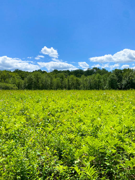
Boy, we are tired! We fell asleep around 9:30pm and didn’t wake up until about 7:30am. Everyone was already gone and we were once again the last people to leave camp. We gained a bit of elevation to a small viewpoint then dropped down to the town of Cheshire. We filled our water at a tent site in town, crossed a few roads, and passed through one of the most beautiful meadows with flowers and raspberries growing. Then, we started the about 7 mile slow climb towards Mt. Greylock, the tallest peak in Massachusetts.
The climb was pretty steady. Nothing too steep, but it was the first sustained climb to a peak we’ve had this entire time. Kevin was pumped about finding some chicken of the woods mushrooms that Kathy immediately and perhaps somewhat irrationally told him not to eat (even if they are edible)! The terrain started changing and we noticed more firs and pines, signaling that we were getting into the real New England mountains.
Around 1:30pm, we made it to Mark Noepel Shelter for lunch. We chatted with Professor K and Up Dog before continuing the last 3 miles to the summit of Greylock. The trail crosses the summit road a few times and close to the top, we passed by a small picturesque pond with a little cabin on the shore. Its still waters reflected the sky gorgeously, so we lingered a minute and took a few pics.
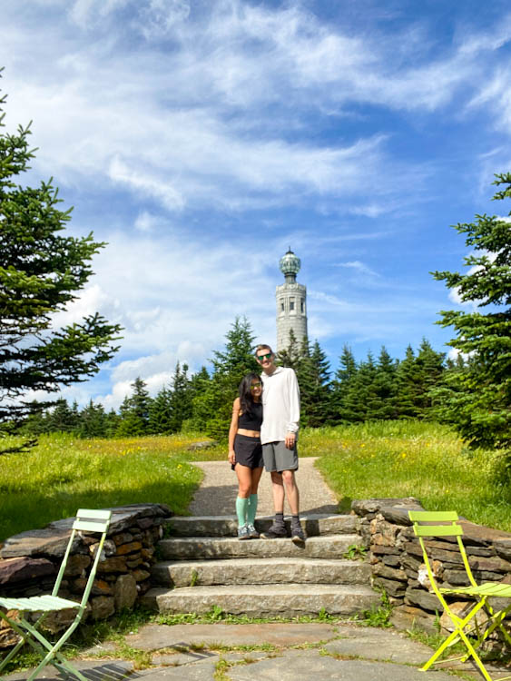
Unfortunately, Bascom Lodge at the summit was closed, but we lounged at the cute chairs and tables outside and filled up water from the spigot on the outside of the building. Many people drive up to the top of Greylock and one person asked if we hiked. When we shared we were thru-hiking he goes oh, that’s “an experience…” He definitely didn’t understand the draw of what we were doing and we had a good laugh about it. We met another thru-hiker, whose name was “Quitter” which was ironic since he started in Alabama (further than the traditional start at Springer) and was even planning to hike all of the Long Trail as well. After over an hour of lounging in the grass and soaking up the sun and breeze, we continued on the last 3.5 miles to Wilbur Clearing Shelter. This was our biggest mileage day. Our feet and ankles were sore and tired but we felt pretty good overall. Almost done with Massachusetts
Day 13, 6/29/22: Wilbur Clearing Shelter to Seth Warner Shelter
10 mi, 2350 ft elevation gain
Another day, another late morning! Last out of the camp again, we got started around 8:00am. Just a brief climb to an overlook and then a 3 mile descent brought us North Adams, where we stopped at a grocery store to grab lunch and resupply. We lounged at a picnic table with fellow hikers: Up Dog and a Swedish couple who do not have trail names yet. Knowing we had only about 7 miles more, we took our sweet time to catch up on emails and calls and sit and relax.
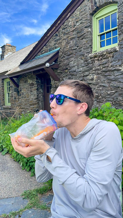
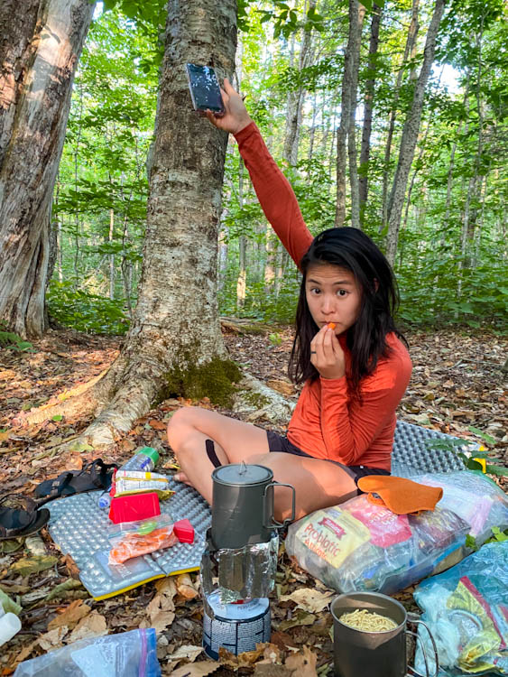
At about 2:00pm, we got ourselves moving (finally). After just a little bit of road walking, we entered the woods and started climbing towards the Massachusetts and Vermont state line. Because we have hiked this section on our Long Trail hikes before (the first 100 miles of the AT in Vermont coincide with the first 100 miles of the LT), we knew exactly what to expect: steady uphill punctuated with a very rocky steep climb, and then a nice and undulating walk along the ridgeline. Even though the climb was difficult, we reflected on how much stronger we are now than we were when we did this section two years ago. Drawing on that strength, we moved quickly and got to camp for a late dinner of ramen and fresh carrots we packed out from the grocery store. Note the picture of Kathy eating carrots and searching for service by holding her phone in the air. Talk about multitasking! Tired, but so excited to enter our third state






















Loving these recaps! I feel like I’m there with you. So happy to see you are able to restock with some great food options. Those salami sammys looked yummy. Also love hearing about all the trail magic. Giving me some ideas for when we see you in VA and I can bring some magic for others too. Also really respect your sleeping “late.” I would 100% be last out of the campsites too. 😉
Die, mosquitoes!